
Barreirinhas
How would you like to explore this place?
Read the guidePlan your stayExplore the villagePlaces, services and conditionsGetting thereCheck conditionsView on the mapFind a place. Choose your next step.
Select a village to find its guides and next steps.
How would you like to explore this place?
Read the guidePlan your stayExplore the villagePlaces, services and conditionsGetting thereCheck conditionsView on the mapHow would you like to explore this place?
Read the guidePlan your stayExplore the villagePlaces, services and conditionsGetting thereCheck conditionsView on the mapHow would you like to explore this place?
Read the guidePlan your stayExplore the villagePlaces, services and conditionsGetting thereCheck conditionsView on the mapHow would you like to explore this place?
Read the guidePlan your stayExplore the villagePlaces, services and conditionsGetting thereCheck conditionsView on the mapHow would you like to explore this place?
Read the guidePlan your stayExplore the villagePlaces, services and conditionsGetting thereCheck conditionsView on the mapHow would you like to explore this place?
Read the guidePlan your stayExplore the villagePlaces, services and conditionsGetting thereCheck conditionsView on the mapHow would you like to explore this place?
Read the guidePlan your stayExplore the villagePlaces, services and conditionsGetting thereCheck conditionsView on the mapHow would you like to explore this place?
Read the guidePlan your stayExplore the villagePlaces, services and conditionsGetting thereCheck conditionsView on the mapHow would you like to explore this place?
Read the guidePlan your stayExplore the villagePlaces, services and conditionsGetting thereCheck conditionsView on the mapHow would you like to explore this place?
Read the guidePlan your stayExplore the villagePlaces, services and conditionsGetting thereCheck conditionsView on the mapHow would you like to explore this place?
Read the guidePlan your stayExplore the villagePlaces, services and conditionsGetting thereCheck conditionsView on the mapHow would you like to explore this place?
Read the guidePlan your stayExplore the villagePlaces, services and conditionsGetting thereCheck conditionsView on the mapHow would you like to explore this place?
Read the guidePlan your stayExplore the villagePlaces, services and conditionsGetting thereCheck conditionsView on the mapHow would you like to explore this place?
Read the guidePlan your stayExplore the villagePlaces, services and conditionsGetting thereCheck conditionsView on the mapHow would you like to explore this place?
Read the guidePlan your stayExplore the villagePlaces, services and conditionsGetting thereCheck conditionsView on the mapHow would you like to explore this place?
Read the guidePlan your stayExplore the villagePlaces, services and conditionsGetting thereCheck conditionsView on the mapHow would you like to explore this place?
Read the guidePlan your stayExplore the villagePlaces, services and conditionsGetting thereCheck conditionsView on the mapHow would you like to explore this place?
Read the guidePlan your stayExplore the villagePlaces, services and conditionsGetting thereCheck conditionsView on the mapHow would you like to explore this place?
Read the guidePlan your stayExplore the villagePlaces, services and conditionsGetting thereCheck conditionsView on the mapHow would you like to explore this place?
Read the guidePlan your stayExplore the villagePlaces, services and conditionsGetting thereCheck conditionsView on the mapHow would you like to explore this place?
Read the guidePlan your stayExplore the villagePlaces, services and conditionsGetting thereCheck conditionsView on the mapHow would you like to explore this place?
Read the guidePlan your stayExplore the villagePlaces, services and conditionsGetting thereCheck conditionsView on the mapHow would you like to explore this place?
Read the guidePlan your stayExplore the villagePlaces, services and conditionsGetting thereCheck conditionsView on the mapHow would you like to explore this place?
Read the guidePlan your stayExplore the villagePlaces, services and conditionsGetting thereCheck conditionsView on the mapHow would you like to explore this place?
Read the guidePlan your stayExplore the villagePlaces, services and conditionsGetting thereCheck conditionsView on the mapHow would you like to explore this place?
Read the guidePlan your stayExplore the villagePlaces, services and conditionsGetting thereCheck conditionsView on the mapHow would you like to explore this place?
Read the guidePlan your stayExplore the villagePlaces, services and conditionsGetting thereCheck conditionsView on the mapHow would you like to explore this place?
Read the guidePlan your stayExplore the villagePlaces, services and conditionsGetting thereCheck conditionsView on the mapOne decision at a time, from itinerary to packing.
A downwind towards the Lençóis.
3 riding days or 5 tour days
Opens a draft message to the Rota Insider team. Replies in Portuguese or English.
Start on the Piauí coast. Cross the shifting water and islands of the Delta do Parnaíba. Pause in Arpoador, where a fishing community sits between the delta and the Pequenos Lençóis. Then follow the coast to Atins, at the edge of the Lençóis Maranhenses.
The journey brings together stretches of open coast, delta islands and connections arranged around the route. Canárias, Poldros and Caju appear in different itineraries before the journey continues towards Arpoador and Atins. The islands you visit and the way you travel between them are part of the plan to agree.
Looking for a guided journey from Barra Grande? Compare two outlines within a three-to-five-day range: a compact route with three riding days, or a five-day journey with time in Arpoador. Tell Rota how much time you have, including travel before and after the ride. These are planning options to discuss, with the actual route confirmed by the operator.
River mouths, mangroves and changing sandbanks.
Illustration sources ↗A fishing community beside the Pequenos Lençóis.
Illustration sources ↗An illustrative coastal scene: sea, sand and dunes inland.
Illustration sources ↗Illustrative planning options. The operator confirms the route, support and complete calendar.
The compact outline connects Barra Grande, the delta, Arpoador and Atins in three riding stages. It concentrates the journey into long days, with little spare time between stages. Arrive in Barra Grande before the first riding day and allow time for onward travel after Atins.
The expanded outline uses five days between Barra Grande and Atins: four moving stages and one pause at Arpoador. It gives the delta a separate day before the approach to Arpoador, then leaves time to recover or discuss a local session before continuing to Atins. Travel to Barra Grande and onward travel from Atins sit outside these five days. Neither outline is a confirmed departure schedule.
| Day | Compact: 3 riding days | Expanded: 5 tour days — 4 moving stages + 1 pause |
|---|---|---|
| 1 | Barra Grande → Canárias / Delta do Parnaíba | Barra Grande → Canárias / Delta do Parnaíba |
| 2 | Delta do Parnaíba → Arpoador | A shorter riding stage within the delta |
| 3 | Arpoador → Atins | Delta islands → Arpoador |
| 4 | — | Arpoador pause or local session, if confirmed |
| 5 | — | Arpoador → Atins |
Illustrative planning outline, not a confirmed departure schedule. The operator chooses the exact islands, launch and landing points, riding stages and any boat or road sections.
Five tour days include four moving stages and one pause. Arrival and onward travel are additional.
For this shorter journey, Barra Grande in Piauí is the starting point. From here, coastal itineraries pass the Luís Correia and Pedra do Sal area before entering the Delta do Parnaíba. The water breaks into river mouths, channels, sandbanks and islands. Canárias is a recurring delta stop; Poldros and Caju appear in other stages and route variations.
Some itineraries ride to an island community. Others use a boat connection before the next riding stage. Published routes often use boats for support or connections in the delta; these are different arrangements, and continuous 4×4 support should not be assumed.
Ask how each day will work: where the group launches, where it lands, when the luggage moves, and what support can reach each section. Those details make the proposal easier to compare and the trip easier to plan.
Arpoador is a fishing community on the Tutóia coast, beside the Pequenos Lençóis landscape. The surrounding area brings together beach, dunes and seasonal lagoons. Praia do Amor lies farther along the coast towards Atins.
Arpoador gives the journey a place to pause. In the three-day outline, it is the end of a stage and the proposed overnight before Atins. In the five-day outline, there is more time between two different sections: the islands and channels of the delta behind you, and the open coast towards Caburé and Atins ahead.
The pause is part of the appeal, but its format needs confirmation. It might be a recovery day, a local session or time around the village. Agree accommodation, meals and equipment support for your group as part of the proposal.
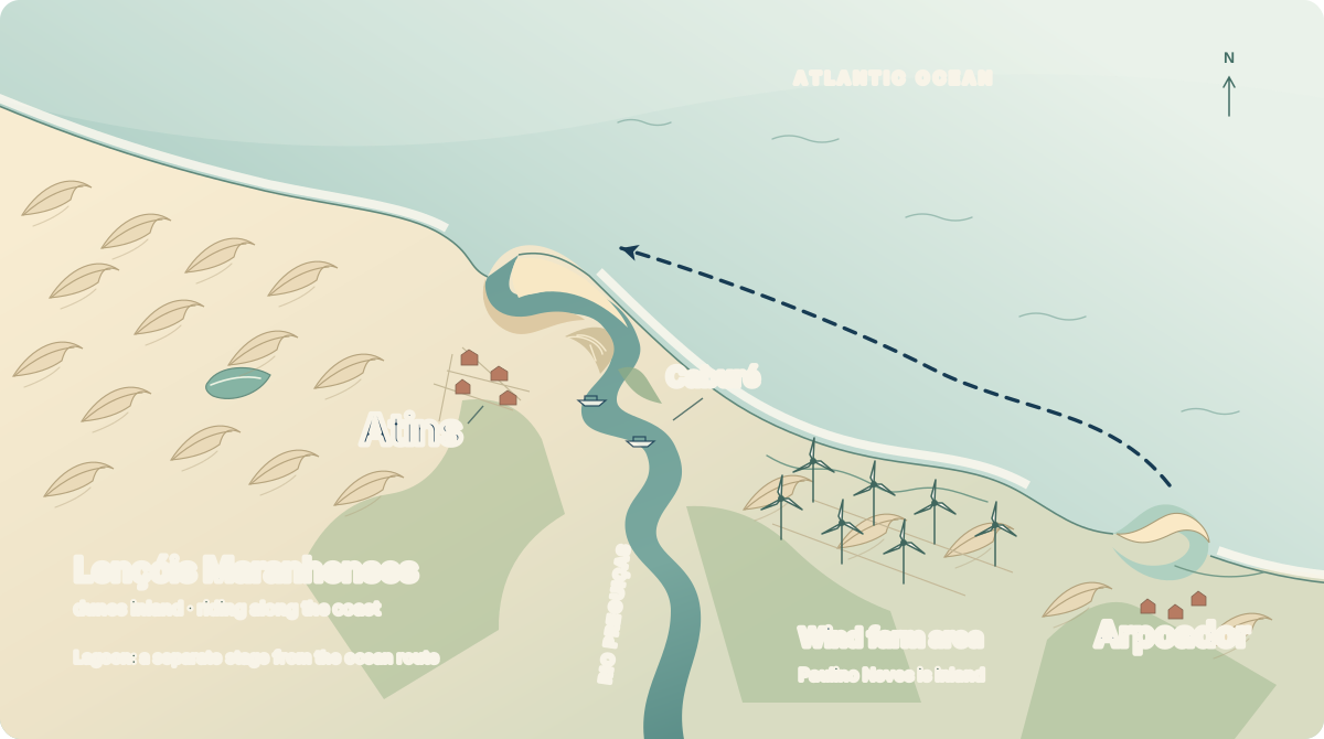
Atins beside the the mouth of the Preguiças River. Caburé between river and sea. The Lençóis stretch west.
The last stage leaves the Arpoador area and follows the coast past Praia do Amor towards Rio Novo and Caburé before reaching Atins. Caburé sits on the strip between the river and the sea; arrival in Atins and the movement of your luggage need to be agreed for that final part of the trip.
Atins is the finish of the coastal expedition. A separate session inside the Lençóis Maranhenses should be treated as another activity, with its own authorised location, access and operator arrangements. Reaching Atins does not make every lagoon available for riding.
Your onward plan also matters. Tell Rota whether you want to stay in Atins, return towards Jeri or continue towards São Luís. The operator can confirm whether and how onward transport can be included, separately from the riding-day count.
Operators describing comparable compact stages ask for experience with long downwinds. Your conversation should cover the routes you have completed, how long you are comfortable riding, your board and kite equipment, and whether you are travelling with your own spares. The operator assesses the fit and explains the support on each section.
The five-day outline leaves room for a pause instead of making every day another long moving stage. It still crosses coastal and delta terrain where the guide, boat plan, communications, exit points and rider requirements need to be confirmed.
Tell Rota what you have in mind, even if your flights are not booked yet. A useful first message includes:
If you have four days or are still deciding, include that in your message. The operator can discuss how your available time affects the stages.
For a longer start on the Ceará coast, see the Jeri to Atins. For a local outing once you are in Atins, compare downwinds around Atins.
Opens a draft message to the Rota Insider team. Replies in Portuguese or English.
Editorial research: 19 September 2026. The planning outlines compare routes described by Kite Nomad, Surfin Sem Fim and Wind Spirit, alongside ICMBio's Delta visitor information. Operator pages describe their own trips. These examples help you compare the pace and ask for a proposal; they do not establish a Rota departure or its inclusions.
The illustrations draw on the Delta’s island and mangrove landscape and the Arpoador coast. The Atins diagram shows only the final coastal sector.
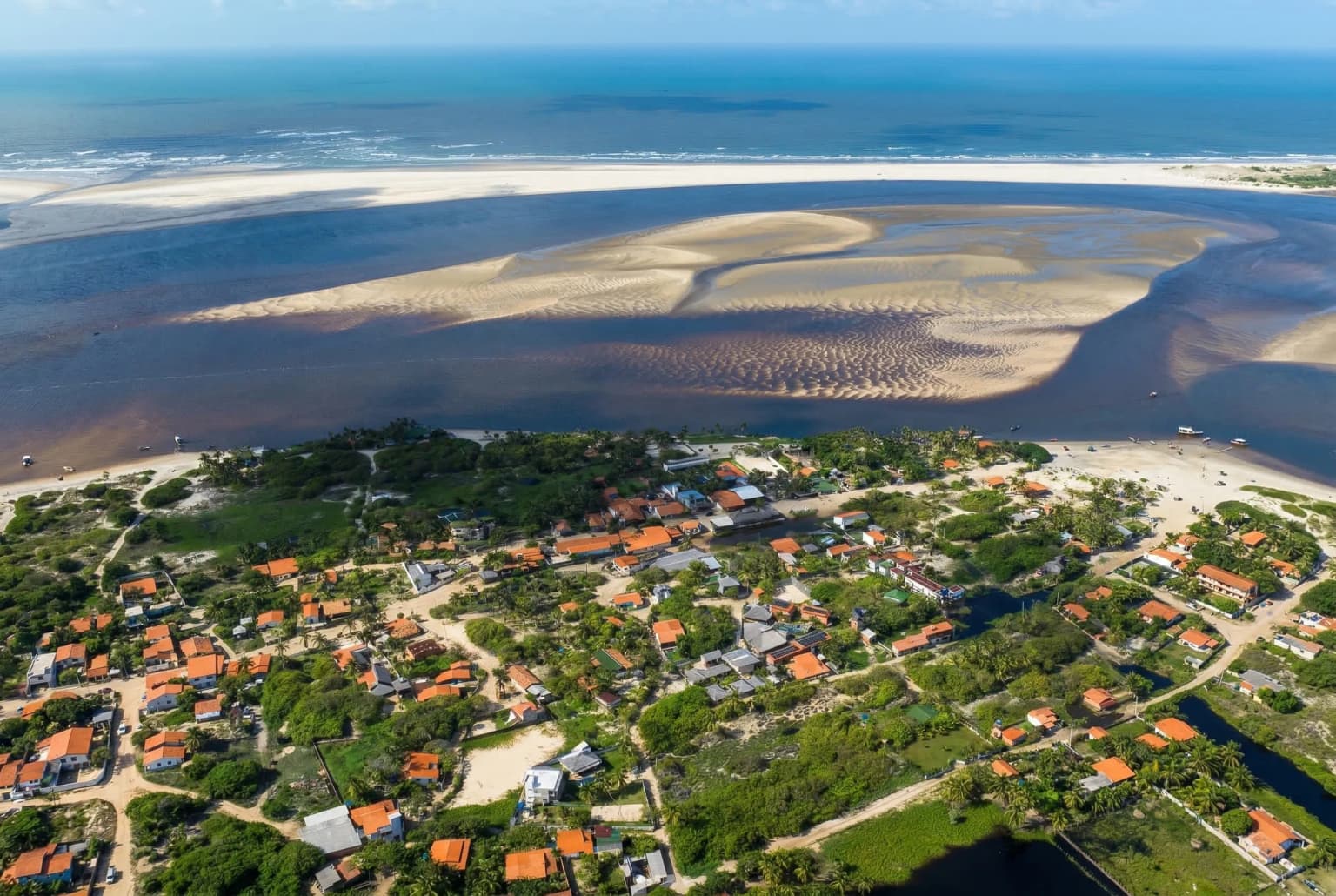
Landscape interpretations, not navigation charts. A photograph records one moment; it does not establish current conditions or a riding route.