

Summary
| Item | Detail |
|---|---|
| What it is | Dunes + freshwater lagoons |
| When to go | May–September as a general guide for more water; levels vary with rainfall |
| Bases | Barreirinhas, Santo Amaro, Atins |
| How to get there | Fly to São Luís + transfer to your base; Santo Amaro: about 4h (shared: 4–4½h); confirm the pickup window |
| Classic tour | Lagoa Azul + Bonita |
Ready to plan? Talk to us — we live here and help you build your itinerary.
Lençóis Maranhenses National Park — eastern Maranhão coast, ~255 km by road from São Luís.
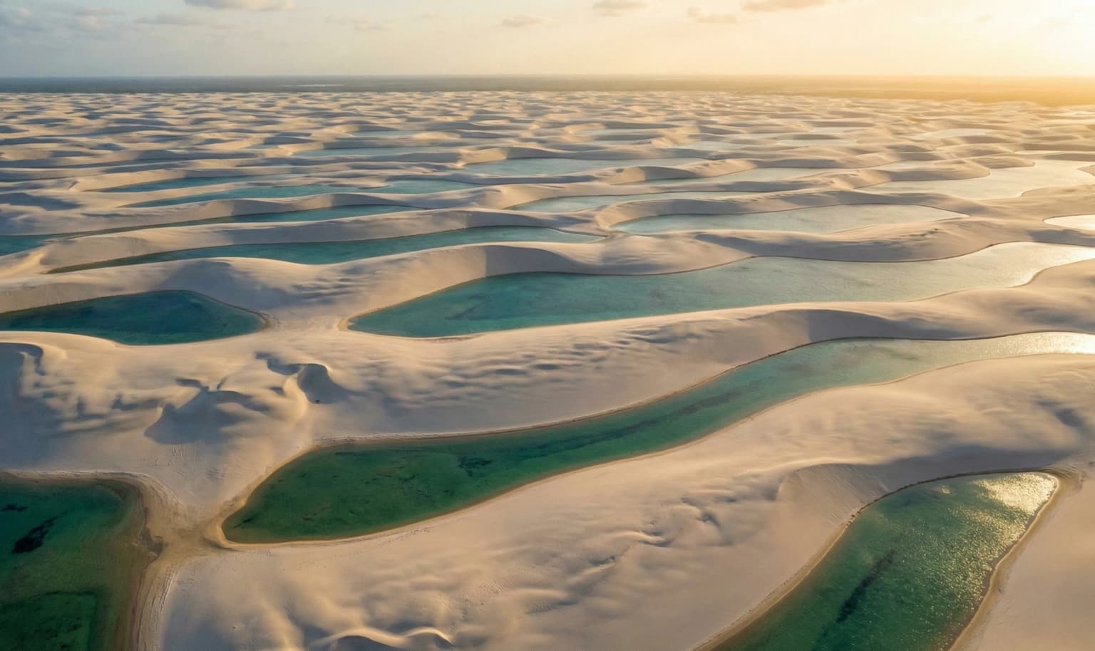
-2.53, -43.07 · OpenStreetMapLençóis Maranhenses is a 155,000-hectare expanse of white dunes with freshwater lagoons in Maranhão — often called "the only desert in the world that has water." A UNESCO World Heritage Site since 2024, the park is accessible from three bases: Barreirinhas, Santo Amaro and Atins.
Where Is Lençóis Maranhenses
Lençóis Maranhenses sits on the eastern coast of Maranhão, in Northeast Brazil, across the municipalities of Barreirinhas, Santo Amaro and Primeira Cruz. The main gateway is Barreirinhas, ~255 km by road from São Luís — the transfer takes ~4h via the BR-135 and the BR-402 (formerly MA-402). Fly into São Luís airport (SLZ). Santo Amaro (about 4h of travel; shared transfers quote 4–4½h) and Atins (a ~1h boat ride from Barreirinhas) are the other two bases. For Santo Amaro, confirm the accommodation pickup window separately.
Is it a desert? Technically, no. The region gets around 1,200 mm of rain per year — nearly five times the ~250 mm that defines a desert. That rain, from January to April, fills the lagoons between the dunes of the largest dune field in South America. Hence the nickname: the "desert" that has water.
When to Go
Rain feeds the lagoons. May to September is a general guide for finding more water after the rainy season, not a guarantee of full lagoons. Levels vary with each year's rainfall and from one lagoon to another. Confirm which circuits are available closer to your trip.
For the complete month-by-month calendar — lagoon levels, crowds and price range — see the guide: When to Go to Lençóis Maranhenses.
Gateways
| Base | Infrastructure | Lagoons | Best For |
|---|---|---|---|
| Barreirinhas | Full | 4x4 | First-timers, families |
| Santo Amaro | Basic | 4x4 or on foot | Adventurers |
| Atins | Rustic | On foot or 4x4 | Kiters, free spirits |
How to Get There
São Luís → Barreirinhas: Transfer ~4h, R$80-150/person*
São Luís → Santo Amaro: About 4h of travel; shared transfers quote 4–4½h. Confirm the accommodation pickup window separately.
Barreirinhas → Atins: Boat ~1h. Examples of shared fares checked in October 2026: R$120 or R$150/person; confirm the fare for your date. See guide →
*Prices can vary significantly depending on season and how far in advance you book.
The Tours
From Barreirinhas
Lagoa Azul + Bonita — R$100-300/person* The classic. 4x4 across the dunes, 3-4 lagoons for swimming.
Rio Preguiças — R$80-200/person* Boat down the river to Caburé.
From Santo Amaro
Lagoa das Emendadas / Betânia Less visited, more pristine. For lagoon visits, confirm the authorized routes with an accredited agency. The July 2026 ICMBio circular prohibits tourist ATVs and UTVs in the park’s dune field.
From Atins and Santo Amaro
Lagoons on foot — 40min to 1h30 walk Check the route conditions and seek advice from an authorized guide. The distance to lagoons with water varies with rainfall and the circuit; confirm the route closer to your trip.
For longer walks — a full day, a night along the way or the whole trek — see the guide to the crossing on foot and other walks in the Lençóis.
What You Need to Know
- Access depends on the circuit: it may combine an authorized vehicle, a boat and walking. Confirm the route before booking. The 4x4 ride in Barreirinhas/Santo Amaro is very bumpy.
- Park access: confirm the route's rules with ICMBio before setting out, including for walks.
- Internet: some establishments in Atins offer Wi-Fi/Starlink. Confirm connectivity with your accommodation at each stop, including Caburé, and save maps and important information offline.
- Walks: check the route conditions and seek advice from an authorized guide.
- Atins: no ATM; some establishments accept cards or Pix. Confirm payment methods in Atins and Caburé and carry cash as an alternative.
How Much Does It Cost
*Prices vary significantly by season: in high season and over New Year's week, accommodation is much more expensive.
| Item | Price Range* |
|---|---|
| Transfer São Luís → Barreirinhas | R$80-200/person |
| Boat Barreirinhas → Atins | Shared-fare examples in Oct 2026: R$120 or R$150/person; confirm for your date |
| Lagoa Azul + Bonita tour | R$100-300/person |
| Rio Preguiças tour | R$80-200/person |
| Accommodation | R$80-600+/night |
Estimate by profile (3-5 days, excluding flights):
| Profile | Total* |
|---|---|
| Budget | R$1,000-2,500 |
| Comfortable | R$2,500-5,000 |
| Premium | R$5,000-10,000+ |
Frequently Asked Questions
How many days are ideal for Lençóis Maranhenses?
A minimum of 2 nights to see the main lagoons. 3-4 nights is ideal to explore at a relaxed pace. If you include Atins, add 2 nights.
Do you need a guide to visit Lençóis?
The rules depend on the route. Before setting out, check access conditions with ICMBio and whether a guide is needed for your chosen walk. For the Travessia dos Lençóis, ICMBio recommends hiring a guide and consulting the specific trekking rules.
Can you drive your own car?
Not inside the park — private vehicles are prohibited. You arrive by transfer to the base (Barreirinhas, Santo Amaro or Atins) and use 4x4/boat/walking to access the lagoons.
Is Lençóis Maranhenses worth it in October?
It can be, but October lagoon levels depend on the year's rainfall and the circuit. May to September is a general guide for finding more water, without a guarantee of full lagoons. Check conditions closer to your trip and choose your base and tours accordingly.
What's the difference between Barreirinhas and Atins?
Barreirinhas has full infrastructure (ATM, pharmacy, more accommodation options) and access to the classic lagoons (Azul, Bonita) by 4x4. Atins is a rustic village with exclusive lagoons accessible on foot, excellent gastronomy and flat water for kite.
Where is Lençóis Maranhenses located?
On the eastern coast of Maranhão, in Northeast Brazil, across the municipalities of Barreirinhas, Santo Amaro and Primeira Cruz. The most-used base is Barreirinhas, ~255 km by road from São Luís (a ~4h transfer).
Is Lençóis Maranhenses really a desert?
Technically, no. The region receives around 1,200 mm of rain per year — far above the ~250 mm that defines a desert. The dunes look like a desert, but the rains form thousands of freshwater lagoons between them.
How far is Lençóis Maranhenses from São Luís?
It's ~255 km by road from São Luís to Barreirinhas, the main gateway — about 4h by van (up to 4h30 with pickups). For Santo Amaro, allow about 4h of travel; shared transfers quote 4–4½h. Confirm the accommodation pickup window separately.
See Also
- When to Go to Lençóis Maranhenses — Month-by-month calendar
- Atins: The Lençóis Village — Alternative base with lagoons on foot
- Rota das Emoções: Full Itinerary — Lençóis is part of this epic route
- What to Pack — Essential checklist
Last updated: October 2026
Know someone planning this trip? Send it their way.