
Barreirinhas
How would you like to explore this place?
Read the guidePlan your stayExplore the villagePlaces, services and conditionsGetting thereCheck conditionsView on the mapFind a place. Choose your next step.
Select a village to find its guides and next steps.
How would you like to explore this place?
Read the guidePlan your stayExplore the villagePlaces, services and conditionsGetting thereCheck conditionsView on the mapHow would you like to explore this place?
Read the guidePlan your stayExplore the villagePlaces, services and conditionsGetting thereCheck conditionsView on the mapHow would you like to explore this place?
Read the guidePlan your stayExplore the villagePlaces, services and conditionsGetting thereCheck conditionsView on the mapHow would you like to explore this place?
Read the guidePlan your stayExplore the villagePlaces, services and conditionsGetting thereCheck conditionsView on the mapHow would you like to explore this place?
Read the guidePlan your stayExplore the villagePlaces, services and conditionsGetting thereCheck conditionsView on the mapHow would you like to explore this place?
Read the guidePlan your stayExplore the villagePlaces, services and conditionsGetting thereCheck conditionsView on the mapHow would you like to explore this place?
Read the guidePlan your stayExplore the villagePlaces, services and conditionsGetting thereCheck conditionsView on the mapHow would you like to explore this place?
Read the guidePlan your stayExplore the villagePlaces, services and conditionsGetting thereCheck conditionsView on the mapHow would you like to explore this place?
Read the guidePlan your stayExplore the villagePlaces, services and conditionsGetting thereCheck conditionsView on the mapHow would you like to explore this place?
Read the guidePlan your stayExplore the villagePlaces, services and conditionsGetting thereCheck conditionsView on the mapHow would you like to explore this place?
Read the guidePlan your stayExplore the villagePlaces, services and conditionsGetting thereCheck conditionsView on the mapHow would you like to explore this place?
Read the guidePlan your stayExplore the villagePlaces, services and conditionsGetting thereCheck conditionsView on the mapHow would you like to explore this place?
Read the guidePlan your stayExplore the villagePlaces, services and conditionsGetting thereCheck conditionsView on the mapHow would you like to explore this place?
Read the guidePlan your stayExplore the villagePlaces, services and conditionsGetting thereCheck conditionsView on the mapHow would you like to explore this place?
Read the guidePlan your stayExplore the villagePlaces, services and conditionsGetting thereCheck conditionsView on the mapHow would you like to explore this place?
Read the guidePlan your stayExplore the villagePlaces, services and conditionsGetting thereCheck conditionsView on the mapHow would you like to explore this place?
Read the guidePlan your stayExplore the villagePlaces, services and conditionsGetting thereCheck conditionsView on the mapHow would you like to explore this place?
Read the guidePlan your stayExplore the villagePlaces, services and conditionsGetting thereCheck conditionsView on the mapHow would you like to explore this place?
Read the guidePlan your stayExplore the villagePlaces, services and conditionsGetting thereCheck conditionsView on the mapHow would you like to explore this place?
Read the guidePlan your stayExplore the villagePlaces, services and conditionsGetting thereCheck conditionsView on the mapHow would you like to explore this place?
Read the guidePlan your stayExplore the villagePlaces, services and conditionsGetting thereCheck conditionsView on the mapHow would you like to explore this place?
Read the guidePlan your stayExplore the villagePlaces, services and conditionsGetting thereCheck conditionsView on the mapHow would you like to explore this place?
Read the guidePlan your stayExplore the villagePlaces, services and conditionsGetting thereCheck conditionsView on the mapHow would you like to explore this place?
Read the guidePlan your stayExplore the villagePlaces, services and conditionsGetting thereCheck conditionsView on the mapHow would you like to explore this place?
Read the guidePlan your stayExplore the villagePlaces, services and conditionsGetting thereCheck conditionsView on the mapHow would you like to explore this place?
Read the guidePlan your stayExplore the villagePlaces, services and conditionsGetting thereCheck conditionsView on the mapHow would you like to explore this place?
Read the guidePlan your stayExplore the villagePlaces, services and conditionsGetting thereCheck conditionsView on the mapHow would you like to explore this place?
Read the guidePlan your stayExplore the villagePlaces, services and conditionsGetting thereCheck conditionsView on the mapOne decision at a time, from itinerary to packing.
A downwind towards the Lençóis.
4 or 7 riding days
Opens a draft message to the Rota Insider team. Replies in Portuguese or English.
Start with the Ceará coast and follow the journey west. Guriú and Tatajuba come first, then Camocim, Piauí and the islands of the Delta do Parnaíba. Beyond the Delta, Arpoador begins the final approach to Atins, beside the Lençóis Maranhenses.
Some trips launch in Jericoacoara itself; others start in nearby Preá and pass Jeri. Confirm the departure beach when discussing your trip, especially if you are already staying in Jeri.
This is not one fixed line on a map. Different expeditions choose different beaches, islands and connections. Some sections can be ridden. Others may call for a vehicle or boat. The shape of the trip depends on the number of riding days, the group and the plan confirmed for your dates.
A pause on the way, or a proposed first overnight.
Illustration sources ↗A fishing community beside the Pequenos Lençóis.
Illustration sources ↗An illustrative coastal scene: sea, sand and dunes inland.
Illustration sources ↗Illustrative planning options. The operator confirms the route, support and complete calendar.
A four-riding-day outline combines selected coastal and Delta sections with vehicle and boat connections. It is a compact planning option to discuss with an operator. Allow additional time to reach the Jeri area before the first ride and to travel on after Atins.
Seven riding days give the coast more space. Tatajuba can become an overnight, the Delta can have its own stage and Arpoador can be experienced as a place on the way to Atins.
| Option | Rhythm | Best fit |
|---|---|---|
| Express · four riding days | Long, selective stages with vehicle and boat connections | Experienced riders considering a compressed route, with time allowed for travel before and after |
| Fuller route · seven riding days | More coastal stages, with Tatajuba, the Delta and Arpoador built into the journey | Riders who want the route itself to be the centre of the trip |
Your arrival in the Jeri area before day 1, any rest or local-session days, and onward travel after Atins are outside the riding-day count. Ask for the complete calendar and overnight plan before arranging flights or accommodation.
Seven riding stages; a synthesis for discussion. Arrival, rest days and onward travel are additional.
This outline follows a published operator pattern and shows why “express” does not mean “ride every kilometre.”
| Riding day | Illustrative plan |
|---|---|
| 1 · Jeri to Camocim | Leave Jericoacoara, pass Guriú and pause at Tatajuba before continuing towards Camocim. |
| 2 · Camocim to Bitupitá | Ride the coast to Bitupitá, then continue by vehicle to Barra Grande. |
| 3 · A selected Delta crossing | Reposition to the Poldros sector, ride towards Ilha do Caju, then use a boat connection to reach the Tutóia side. |
| 4 · Tutóia / Arpoador sector to Atins | Follow the final coast towards Caburé and Atins. The exact departure beach needs to be agreed. |
Tatajuba is a pause in this compact version. Arpoador may be the launch area or part of the final stage. If either is a priority, say so before choosing four riding days.
A fuller route can separate the coast into more natural chapters. These recurring stages are a planning illustration, not a confirmed departure.
| Riding day | Illustrative plan |
|---|---|
| 1 | Jericoacoara → Tatajuba |
| 2 | Tatajuba → Praia do Maceió |
| 3 | Praia do Maceió → Barra Grande, through the Curimãs and Bitupitá corridor |
| 4 | Barra Grande → the Delta / Canárias sector |
| 5 | A separate Delta day around the Poldros and Caju sector |
| 6 | Delta / Caju sector → Arpoador |
| 7 | Arpoador → Atins, following the coast towards Caburé |
This rhythm makes both Tatajuba and Arpoador part of the story, while giving the Delta its own chapter of riding and boat connections.
Some itineraries begin in Preá and pass Jeri on the first day. Others launch from Jericoacoara itself. If setting off from Jeri matters to you, ask for the exact beach and meeting point in the first proposal.
From Jericoacoara, the westbound sequence begins with Guriú and Tatajuba. It then reaches the Camocim coast, where itineraries may use Camocim town or Praia do Maceió as the overnight. Curimãs and Bitupitá come before Barra Grande in Piauí.
The next stretch passes Macapá, Luís Correia and Pedra do Sal towards the Delta. Canárias, Poldros and Caju appear in different proposals, but the chosen islands and connections belong to the operator's plan.
On the Maranhão side, Tutóia and Arpoador lead towards the Pequenos Lençóis coast. Caburé appears near the final approach before Atins. The exact launch and landing points can change.
Tatajuba comes soon after Guriú. On a compact expedition it can be a place to stop, eat and keep moving. In longer itineraries it can be the first overnight. Tell Rota whether spending a night here matters to you so the operator can confirm whether it fits.
Canárias, Poldros and Caju appear in different proposals. The chosen islands, riding sections and boat connections belong to the operator’s plan.
Ask how support and luggage transport work at each stage.
Arpoador sits in the Tutóia area between the Delta and Atins. Published itineraries give it different roles: an overnight, a local riding day or the start of the final stage along the Pequenos Lençóis coast. Agree its role in your trip. “Tutóia to Atins” and “Arpoador to Atins” can mean different starting arrangements, so ask where the group launches and how luggage reaches Atins.
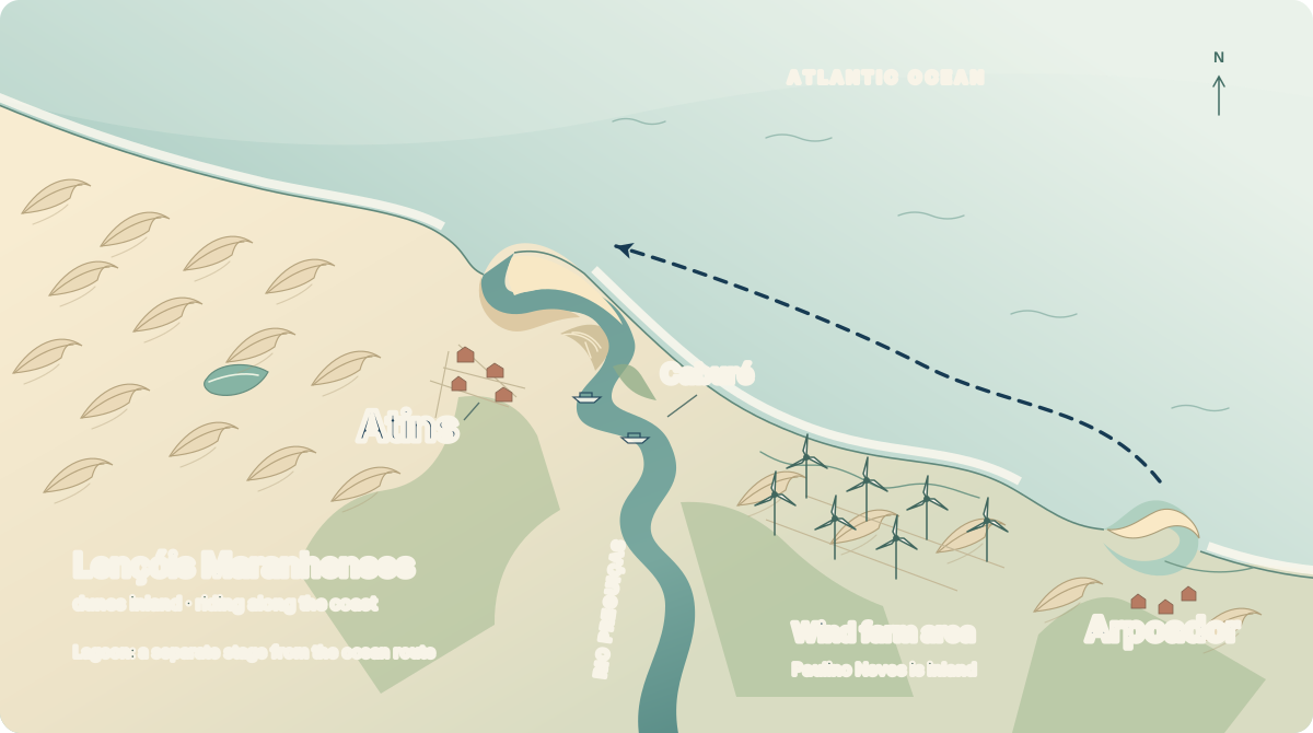
Atins beside the the mouth of the Preguiças River. Caburé between river and sea. The Lençóis stretch west.
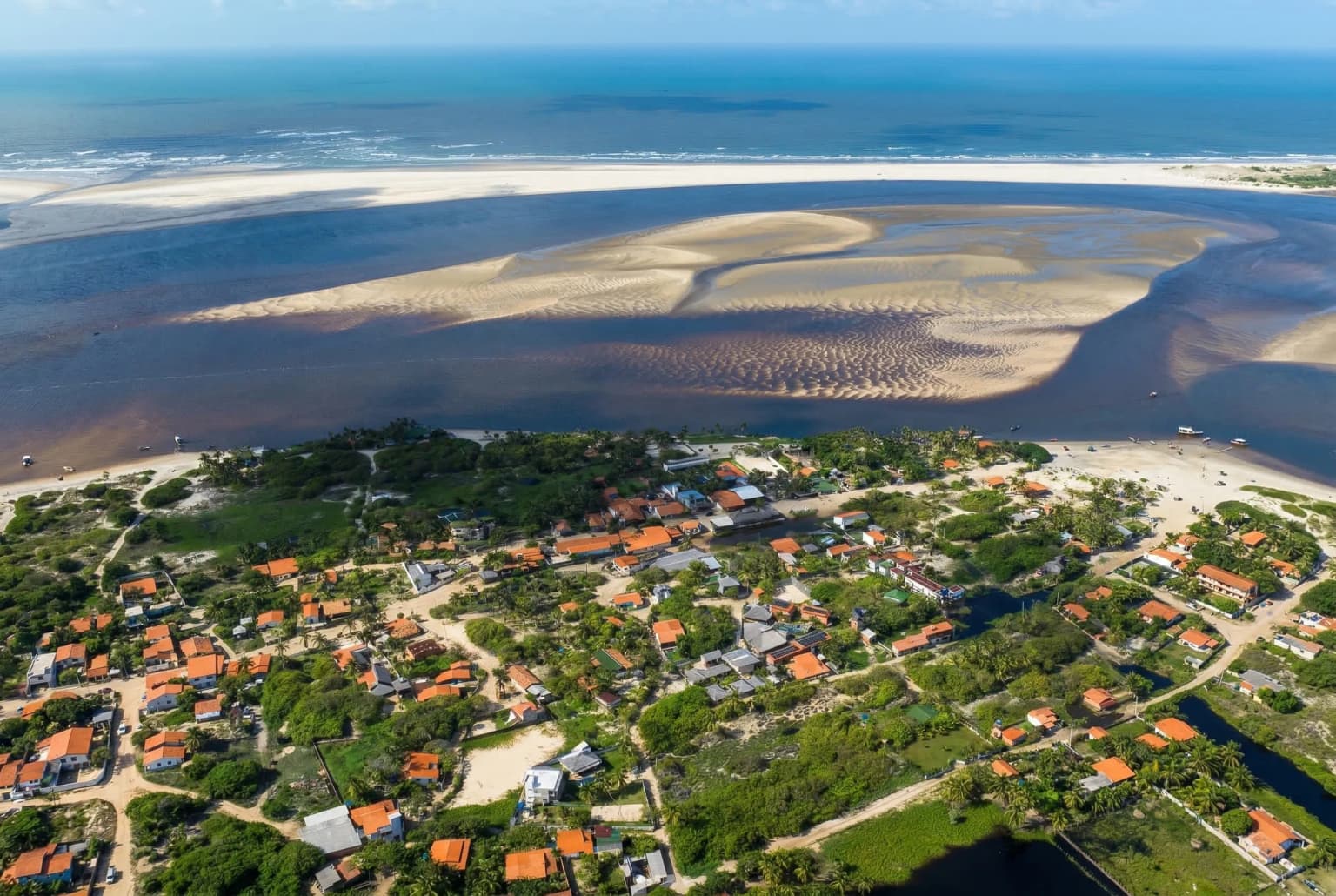
Atins is the finish of the coastal journey, with the option to stay longer if your calendar allows. The village sits beside the Preguiças river mouth, with sandbanks, sea and the Lençóis landscape close by.
A visit to the Lençóis is a separate extension to plan after arrival. If you want to kite in a lagoon, mention that specifically: the operator needs to confirm the authorised location, access and conditions for your dates. Extra time in Atins and a lagoon session are two different requests.
Published operators often ask about kite and board control, toe-side riding, self-rescue skills and previous downwind experience. These are examples of what may be assessed; the operator sets the requirements for the proposed route and each rider. The compressed format leaves less room in the itinerary.
Share the longest downwind you have completed, the conditions you know, your board and kite setup, and whether you will bring spares. The operator should assess the route and explain which sections they can support.
Tell Rota what you have in mind, even if the route is still open.
Include:
Rota can use that brief to explore the right format. The operator's proposal must confirm the exact launch, riding and transfer stages, calendar, requirements, inclusions and price before anything is booked.
If you have five or six days, say how much of that time can be spent riding. The operator can discuss the stages and connections that might fit; the two outlines above are comparison points.
Starting farther along the coast? Compare the Barra Grande to Atins. Already based in Atins? Explore local downwind options.
Opens a draft message to the Rota Insider team. Replies in Portuguese or English.
Editorial research: 19 September 2026. We compared JeriSports, Coco Kite Travel and Wind Spirit with ICMBio's Delta geography. The compact outline draws on a published route with transport connections, whose page currently lists no tour. The seven-stage outline combines recurring stages across operators. Both are planning illustrations, not confirmed departures.
The illustrations draw on the Delta’s island and mangrove landscape, Tatajuba’s coastal inlet and the Arpoador coast. The Atins diagram shows only the final coastal sector.
Landscape interpretations, not navigation charts. A photograph records one moment; it does not establish current conditions or a riding route.