

Barreirinhas
How would you like to explore this place?
Read the guidePlan your stayExplore the villagePlaces, services and conditionsGetting thereCheck conditionsView on the mapFind a place. Choose your next step.
Select a village to find its guides and next steps.
How would you like to explore this place?
Read the guidePlan your stayExplore the villagePlaces, services and conditionsGetting thereCheck conditionsView on the mapHow would you like to explore this place?
Read the guidePlan your stayExplore the villagePlaces, services and conditionsGetting thereCheck conditionsView on the mapHow would you like to explore this place?
Read the guidePlan your stayExplore the villagePlaces, services and conditionsGetting thereCheck conditionsView on the mapHow would you like to explore this place?
Read the guidePlan your stayExplore the villagePlaces, services and conditionsGetting thereCheck conditionsView on the mapHow would you like to explore this place?
Read the guidePlan your stayExplore the villagePlaces, services and conditionsGetting thereCheck conditionsView on the mapHow would you like to explore this place?
Read the guidePlan your stayExplore the villagePlaces, services and conditionsGetting thereCheck conditionsView on the mapHow would you like to explore this place?
Read the guidePlan your stayExplore the villagePlaces, services and conditionsGetting thereCheck conditionsView on the mapHow would you like to explore this place?
Read the guidePlan your stayExplore the villagePlaces, services and conditionsGetting thereCheck conditionsView on the mapHow would you like to explore this place?
Read the guidePlan your stayExplore the villagePlaces, services and conditionsGetting thereCheck conditionsView on the mapHow would you like to explore this place?
Read the guidePlan your stayExplore the villagePlaces, services and conditionsGetting thereCheck conditionsView on the mapHow would you like to explore this place?
Read the guidePlan your stayExplore the villagePlaces, services and conditionsGetting thereCheck conditionsView on the mapHow would you like to explore this place?
Read the guidePlan your stayExplore the villagePlaces, services and conditionsGetting thereCheck conditionsView on the mapHow would you like to explore this place?
Read the guidePlan your stayExplore the villagePlaces, services and conditionsGetting thereCheck conditionsView on the mapHow would you like to explore this place?
Read the guidePlan your stayExplore the villagePlaces, services and conditionsGetting thereCheck conditionsView on the mapHow would you like to explore this place?
Read the guidePlan your stayExplore the villagePlaces, services and conditionsGetting thereCheck conditionsView on the mapHow would you like to explore this place?
Read the guidePlan your stayExplore the villagePlaces, services and conditionsGetting thereCheck conditionsView on the mapHow would you like to explore this place?
Read the guidePlan your stayExplore the villagePlaces, services and conditionsGetting thereCheck conditionsView on the mapHow would you like to explore this place?
Read the guidePlan your stayExplore the villagePlaces, services and conditionsGetting thereCheck conditionsView on the mapHow would you like to explore this place?
Read the guidePlan your stayExplore the villagePlaces, services and conditionsGetting thereCheck conditionsView on the mapHow would you like to explore this place?
Read the guidePlan your stayExplore the villagePlaces, services and conditionsGetting thereCheck conditionsView on the mapHow would you like to explore this place?
Read the guidePlan your stayExplore the villagePlaces, services and conditionsGetting thereCheck conditionsView on the mapHow would you like to explore this place?
Read the guidePlan your stayExplore the villagePlaces, services and conditionsGetting thereCheck conditionsView on the mapHow would you like to explore this place?
Read the guidePlan your stayExplore the villagePlaces, services and conditionsGetting thereCheck conditionsView on the mapHow would you like to explore this place?
Read the guidePlan your stayExplore the villagePlaces, services and conditionsGetting thereCheck conditionsView on the mapHow would you like to explore this place?
Read the guidePlan your stayExplore the villagePlaces, services and conditionsGetting thereCheck conditionsView on the mapHow would you like to explore this place?
Read the guidePlan your stayExplore the villagePlaces, services and conditionsGetting thereCheck conditionsView on the mapHow would you like to explore this place?
Read the guidePlan your stayExplore the villagePlaces, services and conditionsGetting thereCheck conditionsView on the mapHow would you like to explore this place?
Read the guidePlan your stayExplore the villagePlaces, services and conditionsGetting thereCheck conditionsView on the mapOne decision at a time, from itinerary to packing.
Maranhão · Brazil · Hiking guide
A day in the dunes, a night along the way or the Atins–Santo Amaro crossing: choose how much of the Lençóis you want to walk and plan the trip from there.
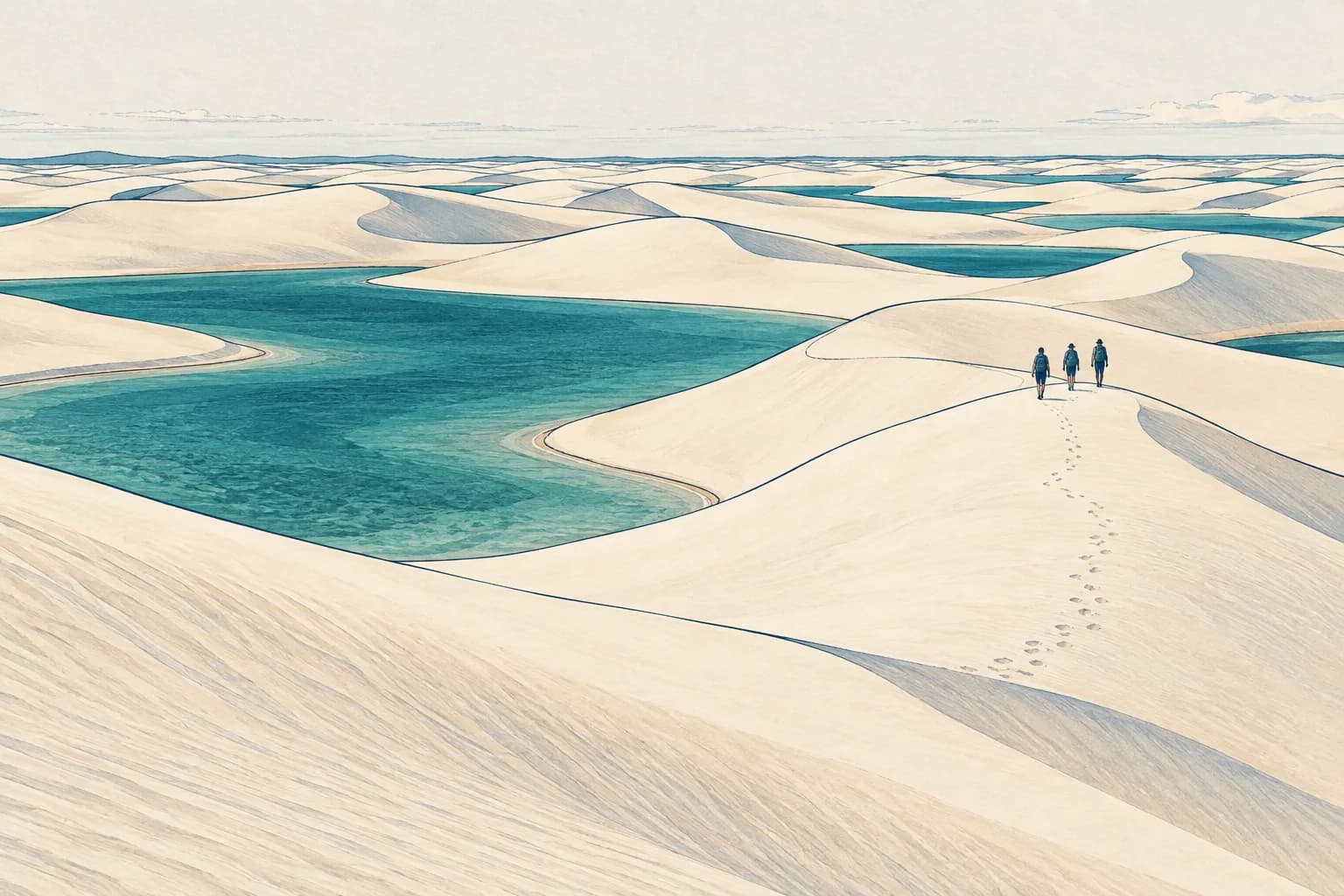
There's a moment when a tour becomes a real walk: the vehicle stays behind, your feet sink into the sand and the next dune hides what lies beyond. In the Lençóis, that moment can last a few hours or repeat itself over several days. You don't need to choose the longest crossing to feel the landscape change with every step.
01 / Your experience
There are three formats: one day, returning to base; two days with a night along the way, which needs a permitted route and a booked stop; or the crossing in stages, with overnight stops and an arrival on the far side.
01 · Back to base
Walk the dunes, leave time for the lagoons and get back the same day. The effort depends on the stretch you choose.
Ask about a 1-day walk02 · A night along the way
An overnight experience — or two separate day trips from your base.
Plan my 2 days03 · Walking in stages
The central oases, the southern route or a longer trek. Compare the walking days, the nights and where you want to finish.
See the routes02 / Your time
One day is enough for a real walk; for the full crossing, there are published itineraries with three to five days on foot. Here's what usually fits the time you have.
How much time do you have?
Travel days or full days for walking? That difference changes the proposal.
If you have 2 days
Spend a night away from your base, or return to it at the end of each day? You can ask for a proposal with that preference.
Request a proposal for 2 days| Your time | A good starting point | The detail that changes the choice |
|---|---|---|
| One day | Outings with a long walk, such as Emendadas or Junco | A lagoon tour by car and a long walk in the dunes are different experiences. |
| Two days | A two-day walk with one night along the way, at a booked stop, or two separate day trips from your base | Sleeping along the way doesn't mean completing Atins–Santo Amaro. |
| Three days | Consider stretches through the central oases or on the southern route | See where each walking stage starts and ends, and how you reach it. |
| Four days | Three walking days between transfers, or days with other activities | A travel day may be nothing but arrival or departure. |
| Five days | More walking days or three walking days between transfer days | There may be four nights on the route — or only two. |
| Six days or more | Extra stretches, time in the communities, rest or kayaking | An extra day isn't always a walking day. |
03 / Route atlas
The best-known crossing links the Atins side with the Santo Amaro side, by way of Baixa Grande and Queimada dos Britos. Some itineraries continue through Betânia; others leave the dune field at Junco, Gaivota or Andorinha before the final leg. The names help you place the experience, but they don't form a single trail for you to follow on your own. ICMBio describes the crossing as a long-distance route through the Zona Primitiva, the part of the park that tourists can only enter on foot.
The route on the ground
One recorded crossing through the oases and, separately, the places on the southern corridor.
Swipe the map to follow the route ↔
A crossing through the oases
Atins → Canto do Atins → Baixa Grande → Queimada dos Britos → Queimada dos Paulos → Betânia → the Santo Amaro side.
The line shows one recorded route, with a stop at Queimada dos Paulos and a boat leg on the Rio Alegre, near Betânia. Other crossings may leave the dunes at different points.
The places on the southern corridor
Lagoa da Esperança, Mocambo and Rancharia.
These places turn up in different itinerary combinations on the southern route. The dots mark the places; the way between them depends on the proposal.
GPS track from April 2018 · Supporting references from 2024 to 2026. Dunes, lagoons and passages shift; settle your route with your local guide.
The line on the map: GPS track by Ju Trekker, April 2018, preserved on AventureBox. Boat legs and gaps in the recording were kept separate.
Other crossings along the same corridor: recordings from 2024 to 2026.
Southern route combinations: one itinerary published by a local operator takes a route through Lagoa Bonita, Mucambo, Rancharia and Junco, and another from the same operator starts at Lagoa da Esperança and continues to the central oases. They are different itineraries; the places don't form a single sequence.
Places on the map: the three points on the southern corridor were approximated from the grid of ICMBio's map of community hubs, drawn up in 2024 and published in the 2025 collection. Mocambo appears as Mucambo on that map and in some itineraries. The points don't indicate places to stay or the exact start of a walk.
Image: NASA HLS S30 v2.0 (Harmonized Landsat Sentinel-2), via NASA GIBS · Sentinel-2 scene of 27 July 2024. Contains modified Copernicus Sentinel data 2024.
Your first step on the sand doesn't always happen in the village the itinerary is named after: see where the walk really starts and ends.
The southern route appears in published itineraries that pass through these communities, with different exits on the Santo Amaro side. It isn't just a shorter version of the way through Baixa Grande and Queimada dos Britos. ICMBio presents Rancharia as an area you can reach by trekking; that doesn't confirm a single route or that overnight stays are available.
Some accounts describe two-day walks with a night in the Baixa da Onça area; where you sleep, how far you walk and how you get back depend on the plan you choose. The distance from a community to a town isn't necessarily the distance you'll walk.
If you want to be back the same day, Emendadas and Junco are examples of outings with a long walk. For Emendadas, ICMBio mentions dune climbs and a considerable stretch on foot. Even so, check the access, timing and effort of the specific outing.
This direction may suit your trip better, as long as access, nights, luggage and departure are planned for it: reading an Atins–Santo Amaro itinerary backward isn't enough. Motorized access follows different rules from one area to another; a vehicle in a listing doesn't mean it's allowed to support you just anywhere in the dunes.
04 / Counting the days
It could be five — or just three. Two itineraries published as “five days” show the difference: one has five main walking stages and four nights on the route; the other has three walking stages and two nights on the route, with the arrival and the return via São Luís taking up the remaining days.
Same number of days. Two different trips.
Comparison drawn from two published itineraries. A walking day can also include a boat ride or transport to reach the start.
See how transfers change the day count.
To make sense of any proposal, count in this order: total days → walking days → nights along the way → longest stage → start and end of the walk → access and exit. Only then compare meals, water, luggage and extra activities.
Be wary, too, of a total distance with no map of what was added up: the start, the exit, detours and conditions change the route, and a boat or kayak leg doesn't turn into kilometers walked. Ask about the moving time, the breaks and the climbs in the sand on each day.
An example with a map: the April 2018 GPS track in our atlas adds up to about 71 km on foot over five days (8 to 24 km a day), plus a short boat leg near Betânia. It's one recording, not the measure of your crossing.
05 / Effort and preparation
A dune looks soft, but walking in loose sand and climbing again after every descent takes energy. Add the sun, the lack of shade, possible stretches through water and a pack on your back. After several days in a row, a stage that looks easy on paper can weigh on you. “Moderate” is too small a word for all that.
Compare the plan with your own experience: which day is the longest, how many days come back to back and how much does each person carry? If you've never walked several days in a row, don't be shy about saying so: a one-day walk or a short overnight can be a way to learn your pace. If you have any health or mobility concerns, raise them at the very start of the conversation: each case is assessed on its own, and no route suits everyone.
Test the footwear you plan to use and listen to the advice of people who know the stretch. There's no rule that says everyone walks better barefoot, or in the same sneakers. Think about sand friction, water and protecting your feet.
06 / Life along the way
On some crossings, the stops are redários — hammock houses, where you sleep in a hammock — and community support points. It's part of the experience of staying along the way, but the community's name doesn't describe the house where you'll sleep. For each night, ask whether there will be a hammock or a bed, bedding for either, insect protection, a bathroom, a shower, a power outlet and shared space.
Ask about meals day by day, including breakfast before you set off, snacks for the walk, drinks and what will be served when you arrive. If you have a dietary restriction, check what the hosts can prepare on your travel dates.
Drinking water on the walk deserves its own conversation: how much to carry when you set off, where you can refill and who provides it. Included meals don't mean drinking-water refills at every stop.
07 / Luggage
Your daypack should match the actual route: the time between confirmed water points, protection from sun and rain, tested footwear, and documents and electronics kept safe. A single day of walking and a run of overnights call for different weights and different care.
Two bags, two plans
Your backpack walks with you.
Your suitcase goes another way.
Agree on what goes in it, and how much it weighs, with whoever is leading the walk.
Agree on who receives the suitcase, where it's kept and how you get it back at the end.
Want help carrying your backpack? It's a separate service: check whether there's a porter for the stretch you choose.
Your main suitcase is another story. Having a suitcase taken by road between bases doesn't mean anyone carries your backpack inside the Zona Primitiva. A large bag, like a kitesurf bag, also has to be accepted by every transport and storage service.
08 / Arrival and departure
Atins, Barreirinhas and Santo Amaro can be your base for the night, a meeting point or the town you arrive in. They aren't necessarily where you take your first or last step: even when the itinerary says “departing from Atins,” a transfer may take you to your first step on the sand, and “arriving in Santo Amaro” may include transport after the last dune. Before you settle the plan, pin down five points: where you sleep the night before; where you meet your guide (or the vehicle that takes you to the start of the walk); where you start walking; where you stop walking; and where you get your suitcase back.
A return time you saw on someone else's itinerary is no basis for buying your ticket home: the last stage and the transfer need to be set in yours.
09 / Landscape and season
After the rains: NASA describes June as close to the typical high-water peak, before many seasonal lagoons shrink in the drier months (the article came out in August; its image was taken on 8 June 2026). The lagoons follow the rains and the groundwater. To plan month by month, see our guide on when to visit the Lençóis.
A landscape on the move
The rains fill the lagoons.
The landscape changes.
Water collects between the dunes. The amount varies from year to year.
June is usually close to peak water, according to NASA.
In the drier months, each stretch can look different.
If getting in the water matters to you, ask for recent news about the stretch you plan to walk. An open park, a full lagoon and an available crossing are different things: in July 2026, ICMBio announced an alternative visiting site in the Rancharia area after another lagoon drained. No month guarantees clear skies, every lagoon full or space at the support points.
10 / Before you set out
For long-distance trails in the 2026 season, ICMBio requires advance booking at the support points and proof of it along the way. Walking groups must stay within the limit of ten people per guide, and walks with at least one overnight require a suitable human-waste container. Glass containers and campfires are banned in the park; the visitor guidance also bans camp stoves. As the crossing page states, registration is required on entry (one form per group) and on exit, at the end of the trail. ICMBio recommends not walking between 11am and 3pm — it's a recommendation, not the park's opening hours.
Tents and vehicle support depend on the area of the park and the matching authorization. If you're traveling in another season, check that year's rules before you book.
11 / What goes into the price
In September 2026, published packages for the crossing with 3 to 5 days on foot, from Atins or Barreirinhas to Santo Amaro, cost from R$2,100 to about R$3,900 per person on group departures, usually without flights or the transfer from São Luís; private departures cost more. These are advertised prices, not a Rota Insider quote: they vary with the experience each operator offers — walking days, type of overnight stay, meals, group size, transfers and luggage.
So there's no single price for “the crossing”: dates, route, guide and extra activities change the total too.
Ask for proposals for the same dates and the same group and compare the walking days, the nights and the real start and finish points. Then check what's included, what's paid separately and the terms for changes and cancellations. A date published by someone else doesn't mean there's a spot for you: the support points and the other services need to be confirmed for the plan you're quoted.
12 / Tailored proposal
Share what draws you to the Lençóis — a long walk, a night deep in the park, the lagoons or simply more time on foot and less in a car — and the team will look for the right partner for your request among local guides and operators, then present the options it can quote, with times, included services and terms. Nothing on this page books you a spot, a guide or a route.
A walk that fits your trip
Tell us how much time you have and any times you need to work around.
You don't need to know the name of a route.
The form puts together a message for you to review. Nothing is sent automatically.
Opens a chat with the Rota Insider team. Replies in Portuguese or English. Once it's copied, open the chat and paste your request. The link doesn't carry your answers. The itinerary, times and price are subject to review and confirmation.
13 / Practical questions
The ICMBio rules for 2026 don't mention a mandatory guide: they require booking at the support points and limit groups to ten people per guide. An older management plan for the park, however, provides for accompanied visits in the Zona Primitiva. Our recommendation: do the crossing with an accredited local guide — there's no trail marked end to end and the lagoons change throughout the year. If you're thinking of going on your own, check with ICMBio first.
It depends on the itinerary: there are published crossings with three, four or five days on foot, and the trip can run longer once you add arrival and departure. Count the walking days, not just the total.
There's no single total: it depends on the starting point, the route and the days on foot. One example: the 2018 GPS track in our atlas adds up to about 71 km on foot over five days. See what to ask about distance.
Not necessarily: two days can allow for a walk and a night along the way, but that alone doesn't mean crossing from Atins to Santo Amaro.
Yes, you can ask for two separate day trips from your base instead of a route with an overnight stay.
Yes. Emendadas and Junco are examples of outings with a long walk and a same-day return. Share your base, your dates and whether you'd rather walk more or spend more time at the lagoons: the team looks for the right partner guide or operator and tells you what it can quote.
On some crossings, in redários (hammock houses) and community support points; hammock or bed depends on each night's stop. Ask for a description of the stops before you choose.
In September 2026, published packages with 3 to 5 days on foot cost from R$2,100 to about R$3,900 per person on group departures, usually without flights or the transfer from São Luís. That's not a Rota Insider quote: see how to compare offers and prices.
Your main suitcase can stay at your base or travel by other transport. As a rule, you carry your own backpack on the walk; a porter is a separate service, arranged in advance.
Nobody can guarantee that in advance: the amount of water, and even the visiting circuit, can change. Close to your dates, ask when and where the conditions on that stretch were observed.
